The earliest known settlers in northwestern Minnesota were the Dakota Sioux who were well established by the late 1600’s. The Chippewa originated on the Atlantic Coast and moved westward to the shores of Lake Superior, and this is where Europeans first visited the Chippewa in 1612. Chippewa movement into the Sioux buffalo hunting grounds was marked by frequent clashes. In 1730, the Chippewa began a relentless march against the Sioux in Central and Northern Minnesota and about 25 years later, the Sioux withdrew from the Red Lake area after a bloody encounter with the Chippewa near the mouth of the Sandy River. By 1770, the Chippewa had become the dominant tribe in a wide area of northern and central Minnesota and the Red Lake Band was recognized as “owning” the entire northwest corner of Minnesota.
In 1863 the Chippewa signed a treaty with the Federal Government, which opened up a large tract of land to homesteaders while reserving some of what would later become Pennington County as Chippewa land. When Polk County was formed in 1858, it included what would later be both Red Lake and Pennington Counties. In 1896, Red Lake County was formed from part of Polk County, and in 1910, Pennington County was formed from part of Red Lake County.
That first cession of Red Lake lands occurred through this 1863 Old Crossing Treaty. “When this treaty was negotiated, the Chippewa Indian leaders were conned into turning over 11 million acres of prime real estate in Northwestern Minnesota and Northeastern North Dakota for about half a million dollars. As far as real estate deals go, the ceding of the Red Lake Valley ranks up there with the Manhattan deal, the Louisiana Purchase, and the Alaska deal. It has been characterized as one of the most dishonest and fraudulent deals ever made.” (Grand Forks Herald, September 25, 1988)
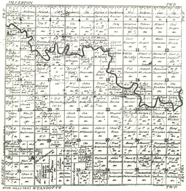
Part of this treaty’s border was set at an angle leading southeast from Thief River Falls (shown as a dotted line on Figure 2. Smiley Township 1911 plat map). The portion of lands to the west of this dotted line were referred to as the “Fraction” and homesteaders began settling here in the early 1880’s. After some years, a road called “The Angle Road” was built from Thief River Falls heading southeast on this diagonal border.

Figure 1.
1911 Plat Map for Smiley Township
Further diminishing of the Red Lake land base occurred on March 10, 1902, when the Red Lake band ceded the area adjoining the Thief River and Red River Valley lands known as the Western Townships or “Eleven Towns.” In 1904, this agreement was ratified and the land was surveyed. The final government land sale of 256,132 acres was held in front of the Thief River Falls high school building that same year. This sale allowed settlers to move onto lands to the east of the Angle Road.
The 36 sections that ultimately became Smiley Township were named after William C. Smiley, who in 1904 was the county surveyor and in later years practiced law in St. Paul. A post office named Anton was established in 1904 and located in Section 10. Peter O. Berg was the postmaster. It closed in 1910.

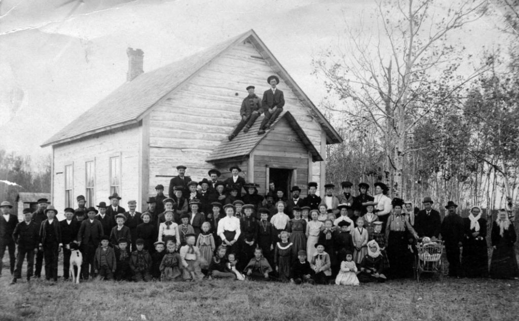
The first school, Washington District 221, in what later became Smiley Township was located in Section 31 in the portion called the “Fraction.” The first school building was log and it also housed the St. Pauli Norwegian Evangelical Lutheran Church congregation until they could erect a church building, which they did across the border in Rocksbury township. In 1915, a new school building was constructed and classes were held at this school until 1956, when the district was consolidated with the Thief River Falls school district.
Other schools were located in Sections 6, 8, 11, and 23, but District 221 was the only one to last into the 1950’s.
Smiley Township has only one church: Bethany Lutheran. It was dedicated in 1906 and the first burial took place in 1914. It is part of the Goodridge parish.
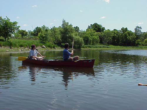
Pennington County is the flattest county in Minnesota, as evidenced by the winding path of the Red Lake River. This beautiful river, whose origin is to the east at Red Lake, meanders for 13 miles through Smiley Township and provides ample opportunities for fishing, canoeing and kayaking.


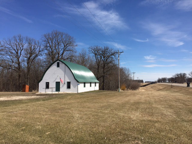
The Smiley Bridge crosses this river between Sections 10 and 15 and it is at this corner that the town hall is located. It was built by the Smiley Community Club:

“The Smiley club will be hosts at a pre-dedication party in their new community hall Sunday evening, November 25, at eight o’clock, inviting as their guests all those who made donations toward the erection of the building. The hall is located five miles southeast on the Angle road, with signs indicating directions from there on.” Thief River Falls Times, November 22, 1934.
In 1935, the Angle Road became U.S. Highway 59, a border-to-border route that begins at the Canadian border north of Lancaster, MN and continues to the Mexican border at Laredo, TX.

Farming has always been the mainstay of Smiley Township. What began with manual labor and oxen blossomed into a combination of mechanical and manual with the broader availability of threshing machines and modest trucks. When settlement first occurred, every farm family had milk cows, pigs, sheep, chicken and large vegetable and fruit gardens. Farm wives traditionally tended the chickens with the “egg money” being used to purchase household items.
As manufacturing and technology have evolved, we are now in an age of precision agriculture or site-specific farming made possible by combining the Global Positioning System (GPS) and geographic information systems (GIS). These systems are being used for farm planning, field mapping, soil sampling, tractor guidance, crop scouting, variable rate applications, and yield mapping.